Yesterday we had a relatively long day's driving from near Dublin up here to Ireland's northernmost cottage (just a short walk from the island's northenmost point). Our County Kildare landord suggested in parting that if the trip from there to here were his to plan, he'd have routed it way west to Sligo so as to avoid Northern Ireland altogether, particularly at this time of year. But I wanted to see and photograph the site of Emain Macha, outside Armagh. We met no trouble whatsoever, and were astonished at meeting not even a checkpoint in passing from the Republic to Northern Ireland and back. (We're in the Republic here, though further north than any part of Northern Ireland.) Apart from a bunch of places offering currency exchange--and all the more for a bunch of advertisements for fireworks--it was more like passing from one to another of the United States than like crossing any international frontier, let alone a violently contested one. The only signs announcing the border were the "Welcome to" kind, welcoming us to the Northern Ireland town of Newry and the Republic's County Donegal, without even mentioning any larger sovereignty in either case. Along our way through Northern Ireland, we did notice numerous curbs painted in Union Jack colors, and a lot of Unionist flags (including the Union Jack, the red and white heraldic flag of Ulster, and some that were bordered in orange). We also saw some Unionist graffiti--plus in a few places the Republic's flag, expressing the contrary Nationalist sentiment.
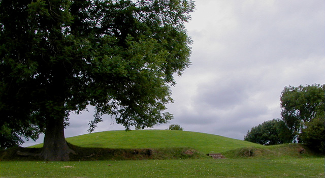
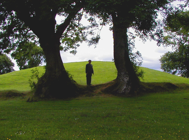
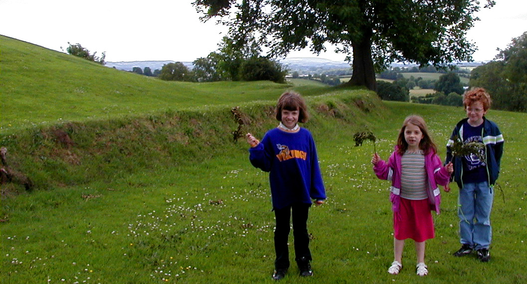
Our one stop in Northern Ireland was Emain Macha or "Navan Fort" just a couple of miles west of Armagh. Here Conchobor (aka Conor) mac Nesa reigned as king of Ulster, the king whom Cúchulainn served in the Táin. He is portrayed in the ancient stories as a revered figure but dreadfully devious, selfish, treacherous, and generally untrustworthy and unsympathetic. It is the conduct and characters of those around him, including Cúchulainn himself, that give the many tales set here the good old heroic flavor. The visible remains of the iron-age citadel consist as usual merely of low earthen circular ramparts ringing a hilltop. In this case two concentric rings are clearly visible to the visitor on foot. These photos show the inner of these, and the venerable ash trees growing out of it.
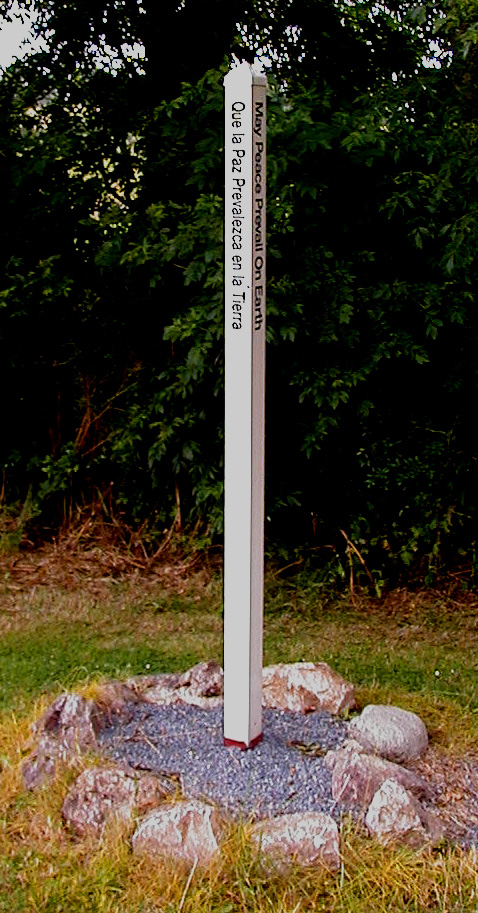 The visitors' center was closed due to fire--how suspicious in origin, if at all, I do not know. Nearby we found this multi-lingual peace pillar, striking not only in its contrast to both the modern history and ancient mythology of the region, but also in that there was one much like it very near our house in Bemidji. The last I saw that one, it had been maliciously uprooted and pitched down the wooded bank sloping down to the lake--a scurvy trick worthy of the battle-goddess Morrígan. I wonder if that sort of thing happens much to this one.
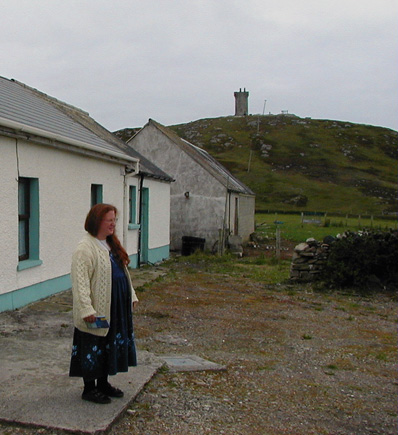
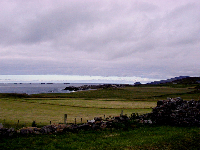
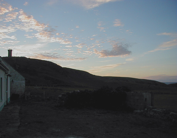 We are delighted with our new place. The accommodations are a little bit rougher than in our previous two self-catering places, but the setting is truly spectacular. Here you see Stas looking out from before the door, and also part of the prospect she's looking at. (Another part of it features the offshore island called Inishtrahull; Larissa can even see its lighthouse, flashing its signature sequence, through the window from her pillow as she falls asleep.) The high headland you see beyond Stas is where the actual northenmost point of Ireland is found. The tower atop it has a few machicolated bits of parapet but is sheathed in concrete and dates only from 1806, when the British Admiralty wanted to keep track of ships crossing the North Atlantic. On the right here you see the same headland and tower viewed near sunset (which does not come till about ten p.m. at this latitude and time of year).
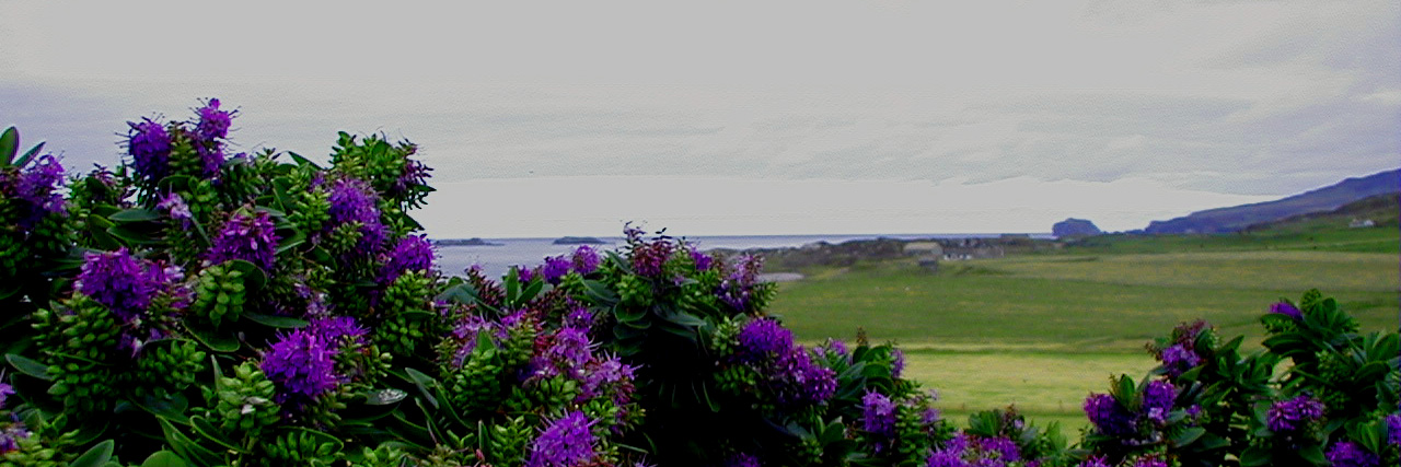 This purple-flowering shrub stands in front of the cottage. We like it but cannot identify it. Can you (Guv)?
We had got up early, and because we had to go back some distance to procure cash, groceries, and later some matches for the pilotless gas stove, we did not get dinner on or go to sleep till quite late. We were all very tired out by the time our heads hit our pillows.
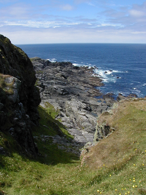
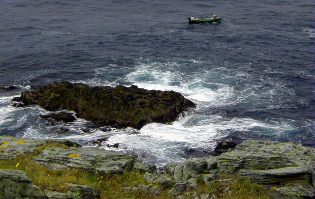
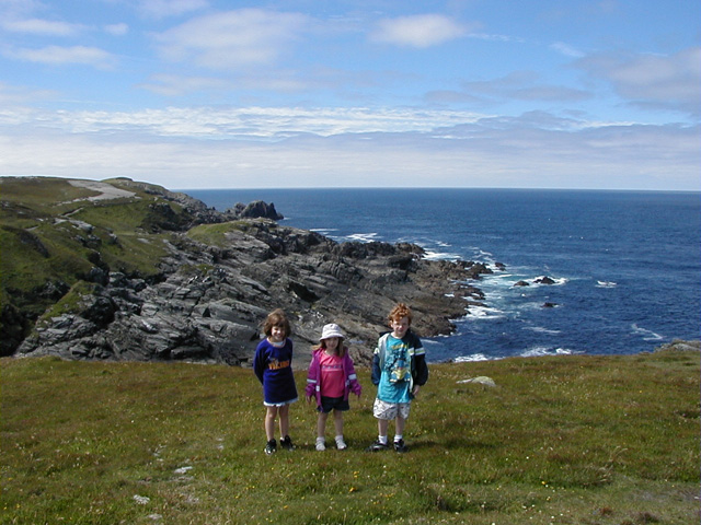 Today we all climbed up to the admiralty's tower, and on the way up Stas got her first good look at the heather she had so often read mention of when she was an English major. The hill was covered with it, and she found it rather more moss-like than she had expected. Like seemingly everything else (except the Muckross rhododendrons), it was in bloom. We proceeded down the other side of the headland to where we could overlook the surf breaking in a craggy hollow of the coastline. During World War II, the neutral Irish Free State wrote its name in whitewashed rocks hereabouts lest the Nazi bomber pilots mistake it for the not-so-neutral United Kingdom. This seems to have started a vogue for writing one's name in loose rocks on parts of this headland--a vogue that all three of our children duly followed.
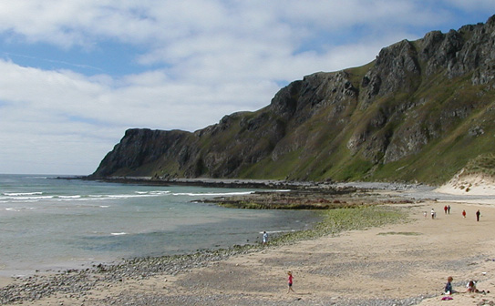 Later I took the kids out exploring the locale, armed with a large-scale topographic map of the Inishowen peninsula (by "Suirbhéireacht Ordanáis na hÉireann"), which I had obtained when first I knew we'd be staying here. We wound up at Five Fingers Strand, where the children started a sand castle (bottom right). Unfortunately construction had to be called off when Ariadne, detailed to go fetch wet sand from the sea's edge (bottom center), tripped there and got soaked herself.